
Walking Elmwood Park Streets
The first pass through an Elmwood Park street directory begins with a specific address. The county assessment search may return an assessed owner and block, lot, or qualifier. The Parcel Viewer then provides parcel geometry and adjoining-lot context. Next, a land-record search can document recorded party roles and dates. A voter status tool or county list request has a much narrower election-administration purpose and includes legal limits. Historical directories, yearbooks, maps, and newspapers can add a dated household clue only after the parcel trail is stable.
Keep a short log with the address as entered, the result date, the source, and the evidence type. This avoids turning an Elmwood Park property record into a claim about who lived there. The same discipline helps when an old record uses the East Paterson name.
- Run the address through the Bergen assessment search, then save the block, lot, and qualifier.
- Open the Bergen Parcel Viewer to confirm parcel location and adjacent shapes.
- Search the County Clerk land-record index for the transfer trail and legal description.
- Use an official election route only for lawful registration or district research, with protected-voter rules in mind.
- After the parcel is confirmed, request local historical material by address, old place name, and year.
Note: An address search becomes more reliable when parcel identifiers and document dates agree across two independent record families.
Elmwood Park Assessment Fields
The county-linked assessment portal is the key modern address tool for an Elmwood Park street directory. Its visible controls include selectors for database, county, district, search format, output format, and items per page. The criteria are Location, Owner Name, Block, Lot, and Qualifier. Select Bergen County and Elmwood Park when the district control permits it. Location is the useful field for a street search; block and lot help distinguish a particular parcel when street names or numbers repeat.
The Bergen assessment search captures the actual controls available to the public.
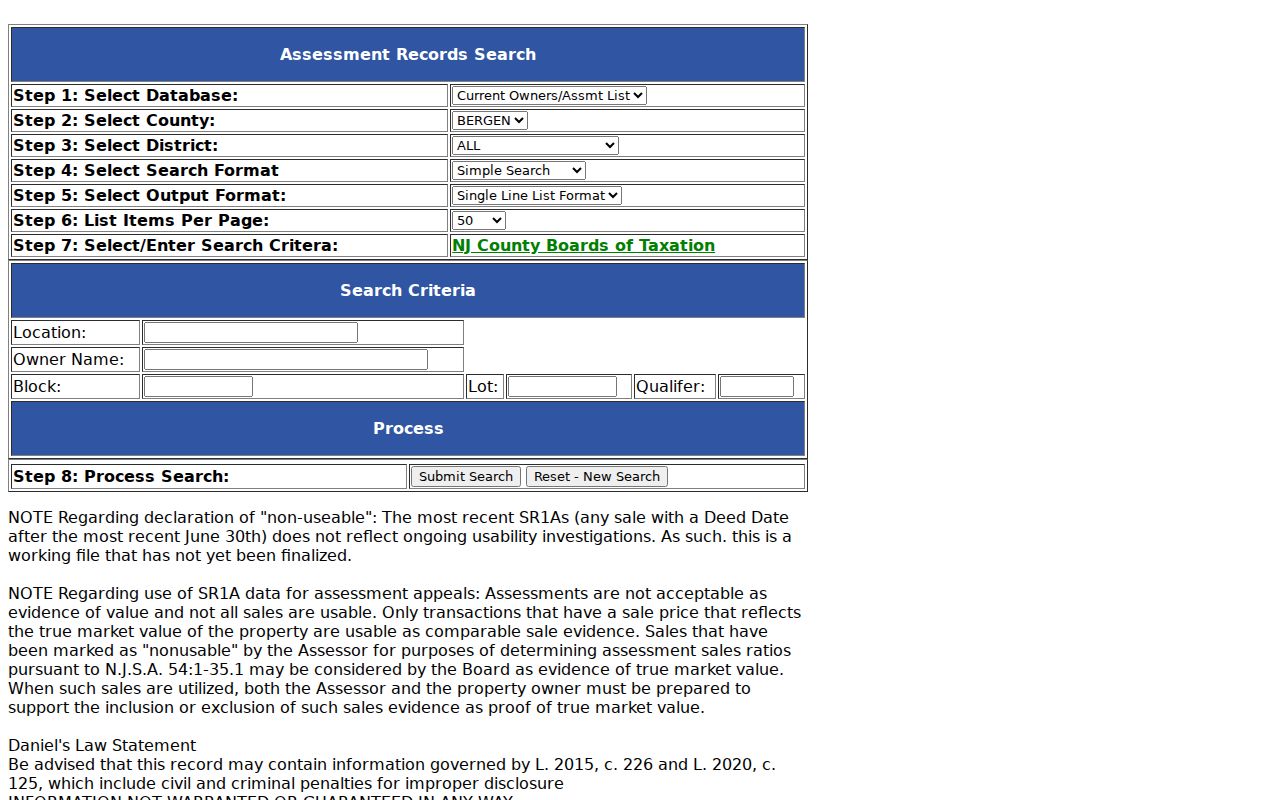
The database warns that recent SR1A sales after the latest June 30 may not be final and that sales information is a working file. It also contains a Daniel’s Law notice, so do not copy a result as though it were a permanent or unrestricted directory entry.
| Field label | Type | Street-directory use |
|---|---|---|
| Select Database | Dropdown | Choose the available database before entering criteria. |
| Select County | Dropdown | Choose Bergen County. |
| Select District | Dropdown | Choose Elmwood Park where available. |
| Select Search Format | Dropdown | Format options were not fully exposed in the capture. |
| Select Output Format | Dropdown | Output options were not fully exposed in the capture. |
| List Items Per Page | Dropdown | Controls result pagination. |
| Location | Text | Street or address search. |
| Owner Name | Text | Try spelling variants and prior names. |
| Block | Text | Parcel identifier. |
| Lot | Text | Parcel identifier. |
| Qualifier | Text | Sub-lot detail where used. |
| Process / Search | Control | Visible search action; live label should be confirmed. |
Elmwood Park Parcel Map Checks
The Bergen Parcel Viewer is useful for the geography behind an Elmwood Park street directory result. Search the current address, select the parcel, and record the parcel identifier, block and lot, and the shapes that adjoin it. Then return to the assessment and land-record systems for party or value information. The county GIS department identifies the viewer as a county resource and notes a May 2022 update on its information page.
The accessible research did not expose the viewer’s exact address fields, popup labels, export tools, or historical layers. Do not promise those features. Use the map to test Elmwood Park parcel location and neighboring geometry, and preserve the source’s own labels when an interactive result is visible.
Elmwood Park Owners and Occupants
Assessment and deed records do not create a complete Elmwood Park street directory of occupants. An assessment record can show an assessed owner, a situs address, and sometimes a mailing address. A mailing address is a clue, not proof that the owner occupies the parcel. A deed identifies grantor and grantee roles in a recorded transfer, not every person at the location. A parcel map displays geography, not a household roster. Write the evidence type next to a result rather than merging these separate facts.
- Parcel
- A defined tract of land identified locally by block, lot, and sometimes a qualifier.
- Situs address
- The physical address associated with the parcel, distinct from a mailing address.
- Plat
- A recorded map that can help connect a subdivision or legal description to a parcel.
- Criss-cross directory
- An address-organized directory, if the relevant historic repository confirms that it holds a run.
One result can be wrong, stale, or incomplete. A dated directory entry and a recorded deed can both be useful in a historical question, but neither cancels the limits of the other.
Elmwood Park Deed Chains
A deed trail gives the address search its recorded backbone. The Bergen County land-record portal makes public documents available online from January 1, 1970 forward. Start with the most recent transfer found for a confirmed parcel. Record the grantor, grantee, instrument type, recording date, legal description, and book and page or document number when shown. Search the prior grantor as a grantee to locate that earlier acquisition, then repeat the sequence with spelling variants and both borough names.
The Bergen County Land Records portal presents the public basic and advanced search route and its coverage notice.
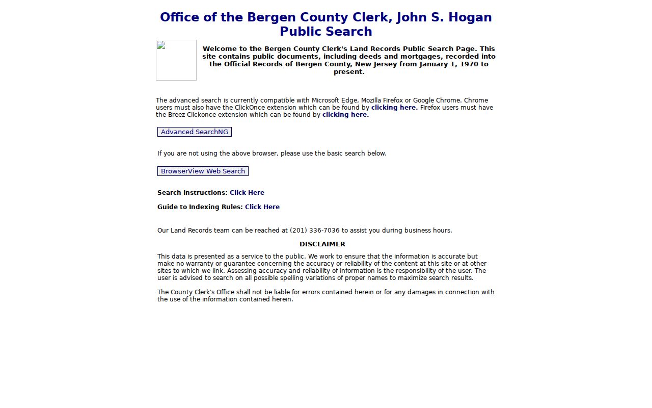
When the chain reaches before 1970, continue in County Clerk deed books, microfilm, archival copies, or the Records Division. County staff can explain the system but cannot perform the search for the requester. Public viewing and copies are available through the division, with copies listed at seven cents per page and certification extra.
Elmwood Park Street Directory Records
Address-keyed systems create the evidence trail behind an Elmwood Park street directory, but each one has a distinct scope. The assessment database holds assessment and parcel clues. GIS supplies map context. The deed index records transfers and other instruments. Election records are limited by access and use rules. Historical directories and maps can supply dated context, while permits and code records may require a focused borough request because no verified public online Elmwood Park permit or code index was located.
| Address-keyed source | What it shows | Access and caution |
|---|---|---|
| County assessment portal | Assessed owner, identifiers, values, and possible mailing or situs distinction | Location, owner, block, lot, and qualifier search; working-file warning. |
| Bergen Parcel Viewer | Parcel geometry, map location, and nearby lots | Exact popup and export fields were not captured. |
| Land-record index | Grantor/grantee, instrument, and recorded date | Online from January 1, 1970; party role is not occupancy. |
| Voter status or list | Registration or district information | Official route, fee and statutory use limits apply. |
| Directories and maps | Historic address, household, street, or building context | Local directory and reverse-run coverage remains unverified. |
| Permits and code records | Possible construction, alteration, or enforcement evidence | Use a narrow request; no public online borough index was found. |
For a one-person question after the address trail is clear, the Elmwood Park resident lookup route keeps the focus on verifying a named individual across separate record types.
East Paterson Street Searches
Historical Elmwood Park street directory work needs the borough’s former name. Residents voted on April 18, 1916 to form East Paterson Borough from Saddle River Township, and Rosemont was annexed in 1917. A 1972 vote made Elmwood Park the official name on January 1, 1973. Search East Paterson, Elmwood Park, Dundee Lake, Rosemont, and Saddle River Township when the record date supports those labels. This is a documented place-name bridge, not evidence of a borough-wide street renumbering.
The January 1925 East Paterson Sanborn map set has eight sheets and can check historic street, block, and building context. It cannot establish current title or a resident. For the printed-directory and yearbook shelf, the Elmwood Park city directory page keeps the repository limits clear.
Elmwood Park Permit Requests
Address-based construction, alteration, inspection, or code evidence may be held by borough offices, but the research found no official public Elmwood Park online permit or code index. Begin with a known Elmwood Park address, date range, and record type. Send a narrow written request to the appropriate building, code, or clerk custodian through the borough’s OPRA process. Ask for existing permits, inspections, notices, or logs rather than an agency-created history of the address.
Inspection is free under the borough’s posted procedure, and electronic delivery may be available. The municipality says some material can be immediately available while most responses operate on the seven-business-day framework. If a record is redacted or unavailable, retain the custodian’s explanation and response date.
Elmwood Park Postal Clues
ZIP 07407 is useful in an Elmwood Park street directory as an address-normalization clue. Borough pages use it, and the USPS Elmwood Park Post Office is listed at 335 Mola Boulevard with ZIP+4 07407-9998. That is postal routing evidence, not a legal parcel or borough-boundary map. A Postal Bulletin destination list that places 07407 alongside nearby labels also does not prove that every listed ZIP serves Elmwood Park residents.
Use a precise address, parcel identifier, or municipal GIS result to resolve jurisdiction. A ZIP alone is broad, and it cannot solve the historic East Paterson name problem.
The state Property Explorer is the broader official map alternative when an address needs a second check. It can search by owner, location, or block and lot, but its file is collected in January and later transfers may lag. Compare its annual values and classification with the county record date rather than treating the two systems as a single, live address list.
Note: Verify a delivery address with USPS instead of using a post-office location as a boundary for an Elmwood Park street search.
Elmwood Park Street Privacy
An Elmwood Park street directory cannot properly expose every name tied to an address. Current vital records are confidential, MVC personal information is protected under DPPA rules, and address suppression may apply through the Address Confidentiality Program or Daniel’s Law. A voter record has its own statutory limits. A court, jail, or registry entry also needs its own status and access analysis. Do not treat a map neighbor, a historic directory entry, or an old mailing address as a current resident claim.
New Jersey stalking law addresses a course of conduct that causes reasonable fear or emotional distress. When a safer citation, parcel number, or office contact will answer the question, avoid retaining precise personal-location details.
Elmwood Park Record Scale
The County Clerk’s 2025 figures show the scale of the Bergen system that supports an Elmwood Park street directory search: 87,707 registry documents and 671,000 registered voters were reported as of November 4, 2025. Those are county-wide figures, not borough counts. They help explain why a street, parcel, date, and document identifier are much more useful than a surname alone when searching official records.
The same County Clerk report lists 347,825 ballots, 51.8 percent turnout, and 19 satellite visits for 2025. Those numbers describe operations, not an Elmwood Park household or a particular street. For land records, public viewing and copying are available in the Records Division Monday through Friday from 8:30 a.m. to 4:30 p.m. County staff cannot conduct a search for a requester, but they can explain the system. That distinction makes a prepared query, with a date range and parcel identifier, more valuable at the counter.
Save the exact search terms and no-result state. A search can fail because the record predates online coverage, uses East Paterson, has a variant spelling, is protected, or is held at a different counter.