
Elmwood Park ZIP Code Coverage
The verified postal label for Elmwood Park borough addresses is 07407. Elmwood Park’s official pages use it, and USPS identifies an Elmwood Park Post Office. The source set does not establish a legal Elmwood Park ZIP polygon or show that other nearby destination labels serve Elmwood Park residents. Elmwood Park postal geography is useful for mail routing and address checks. Elmwood Park jurisdiction still comes from municipal and parcel records.
| ZIP | Areas Covered | Post Office | Notes |
|---|---|---|---|
| 07407 | Elmwood Park Borough address usage | Elmwood Park Post Office | Verified Elmwood Park postal evidence, not a legal municipal-boundary survey |
| 07403, 07428, 07432, 07627, 07642, 07657 | No Elmwood Park residential coverage verified | Listed with Elmwood Park 07407 in a Postal Bulletin destination/container list | Routing labels only; do not treat them as Elmwood Park ZIP coverage |
| 07410, 07011, 07652, 07663, 07513 | Nearby Elmwood Park USPS-location context | Fair Lawn, Clifton, Paramus, Saddle Brook, and Paterson alternatives | Nearby offices are not Elmwood Park coverage |
The USPS Elmwood Park location gives the Elmwood Park post office’s address, phone, hours, and ZIP+4. Use it to check an Elmwood Park delivery point. It does not identify an Elmwood Park resident or settle an Elmwood Park city-limit question.
Nearby USPS counters do not expand Elmwood Park’s verified ZIP coverage. Elmwood Park 07407 is supported for borough address usage; other labels need address-specific confirmation.
Elmwood Park ZIP Code Postal Evidence
The USPS location identifies the Elmwood Park Post Office at 335 Mola Boulevard, Elmwood Park, NJ 07407-9998. Elmwood Park Borough pages also use 07407, so the label is a solid Elmwood Park postal cross-check for official borough addresses. Verify a particular Elmwood Park address through USPS instead of extrapolating from the post-office address. That distinction is important when an Elmwood Park address appears in a map, a mailing record, or a historical source with a different locality label.
The official USPS location record supplies the postal location used for this check.
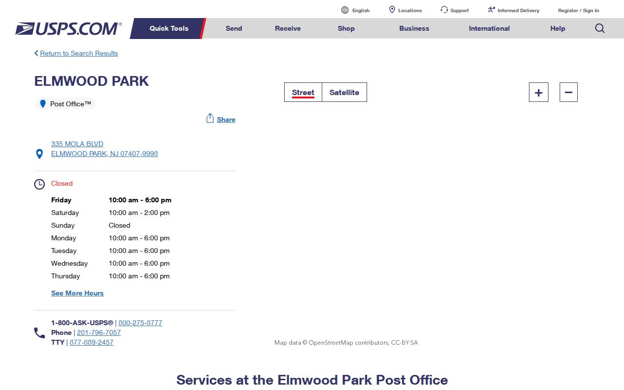
The screen confirms the postal location and ZIP+4, not a property, voter, or municipal record.
The posted retail hours are Monday through Friday from 10 a.m. to 6 p.m. and Saturday from 10 a.m. to 2 p.m.; the listed phone is 201-796-7057. Check the live USPS page before a visit, since service hours can change. For research, save the address exactly as USPS displays it and note any ZIP+4 separately from the base ZIP.
Finding Elmwood Park Records by ZIP
An Elmwood Park ZIP can narrow a broad search, but Elmwood Park property tools work best once it is paired with a full street address, owner name, or parcel identifier. NJ Property Explorer is the strongest official statewide route in the research set. It accepts owner, location, or block-and-lot searching and displays annual land and building values, classification, and prior-year taxes. The state cautions that the data are collected in January, so later Elmwood Park ownership transfers may not yet appear.
- Confirm the mailing ZIP and delivery format with USPS, keeping the full address as entered.
- Search NJ Property Explorer by owner, location, or block and lot when that identifier is known.
- Use the resulting address or parcel clues in the Bergen assessment search, then record the block, lot, and qualifier.
- Check the Bergen County Parcel Viewer to confirm the parcel’s geography and municipality.
- Once the search is down to a street, use the Elmwood Park street directory for the address-based record trail.
Elmwood Park voter, deed, and vital-record routes should not be searched by ZIP alone when a precise name, address, block, lot, or legal description is available. They use different custodians and have different public-access limits.
The Elmwood Park county assessment record may show an assessed owner, a situs location, and a mailing address where displayed. None of those fields alone proves current occupancy. Compare the Elmwood Park record date, source type, and parcel identifiers before carrying a name from one system into another research note.
Elmwood Park ZIP Code Property Search Fields
The Bergen County assessment portal is useful after the Elmwood Park postal label has helped normalize an Elmwood Park address, but the captured form did not expose a ZIP field. It searches Elmwood Park property through location, owner, and parcel details. Do not claim that it filters an Elmwood Park result by ZIP. Search the address and keep the parcel identifiers for a more durable match.
| Field label | Type | Required | Verified use |
|---|---|---|---|
| Select Database | Dropdown | Not stated | Database choice; options were not fully exposed. |
| Select County | Dropdown | Not stated | Choose Bergen County. |
| Select District | Dropdown | Not stated | Choose Elmwood Park district where available. |
| Select Search Format | Dropdown | Not stated | Format options were not fully exposed. |
| Select Output Format | Dropdown | Not stated | Output options were not fully exposed. |
| List Items Per Page | Dropdown | Not stated | Pagination and result-limit control. |
| Location | Text | Not stated | Street or address search. |
| Owner Name | Text | Not stated | Try spelling variants and historic owner names. |
| Block | Text | Not stated | Parcel identifier. |
| Lot | Text | Not stated | Parcel identifier. |
| Qualifier | Text | Not stated | Parcel sub-lot qualifier where used. |
| Process / Search | Button or control | Not stated | Visible action; confirm current wording in the live form. |
The Bergen assessment search also shows database, search-format, output-format, and items-per-page controls. Its page warns that recent sales information can be a working file. A blank result is a search or coverage question, not proof that a parcel never existed.
The county GIS page says the Elmwood Park Parcel Viewer route was updated in May 2022, but the accessible capture did not expose its exact address fields, popup labels, export controls, or historical layers. Use the viewer for Elmwood Park parcel geography and adjacent-lot context. Use the assessment and land-record systems for the ownership and recorded-instrument questions that a map cannot answer.
Elmwood Park ZIP Code Boundaries and City Limits
ZIP boundaries can cross municipal lines, and an Elmwood Park mailing city can differ from the legal municipality. No machine-readable USPS city/ZIP boundary result or legal ZIP polygon was captured for Elmwood Park. The reliable Elmwood Park method is to use 07407 for postal routing, then check the Elmwood Park borough and the county GIS or parcel record for jurisdiction. Do not draw an exact Elmwood Park borough ZIP map from the Postal Bulletin destination list.
- ZIP and ZIP+4
- The five-digit ZIP directs broad routing; the added four digits refine delivery within that system.
- PO-box ZIP
- A ZIP used for post-office boxes. It is not evidence that the same ZIP defines a surrounding delivery area.
- Unique ZIP
- A ZIP assigned to a single organization or destination. The research did not verify one for Elmwood Park.
- Carrier route
- A postal delivery grouping. It is not a parcel boundary and does not identify everyone connected to an address.
- Block and lot
- County parcel identifiers that are more useful than a ZIP when matching an Elmwood Park property record.
For Elmwood Park municipal records, the Borough Clerk is the local custodian and the County Clerk holds Elmwood Park recorded land records. An Elmwood Park postal match does not choose between them. Send a narrow request to the office that keeps the specific record, with a date range and the address or parcel identifier, rather than asking an office to infer jurisdiction from a ZIP alone.
Elmwood Park ZIP Code History and East Paterson
An Elmwood Park modern postal label does not repair an old place-name search. The Elmwood Park borough was East Paterson until the name change became official on January 1, 1973. Elmwood Park municipal history also ties earlier material to Saddle River Township, Dundee Lake, and the 1917 Rosemont annexation. An Elmwood Park historical directory, Sanborn map, yearbook, deed, or newspaper can use those earlier terms even when an address is now mailed as Elmwood Park.
The January 1925 East Paterson Sanborn map set has eight sheets. It can place a street or building in its historical setting, but it does not show current occupancy. Search both names and preserve the label printed on the original record.
The borough history is the primary local source for the rename. Add its timeline citation when a historical search switches between East Paterson and Elmwood Park, rather than silently treating the labels as identical.
Elmwood Park ZIP Code Postal Bulletin Context
The USPS Postal Bulletin list places Elmwood Park 07407 alongside 07403, 07428, 07432, 07627, 07642, and 07657 in a container or destination context. It is tempting to read that Elmwood Park row as a service-area map. The source does not support that conclusion. Those labels are useful only as a prompt to verify a specific Elmwood Park address through USPS and the relevant municipal or parcel office.
The USPS Postal Bulletin entry is the source for this routing context.
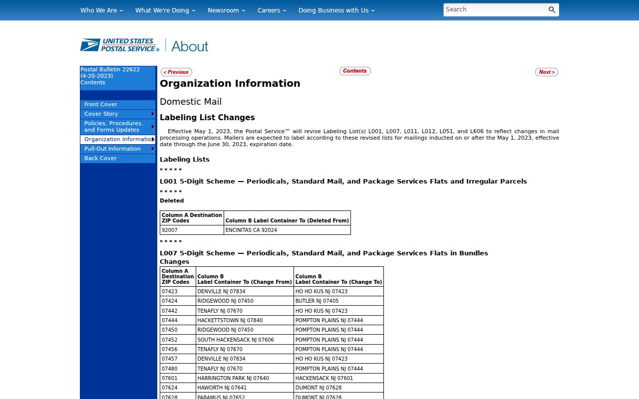
The bulletin image documents the listed postal labels, not a complete boundary or a count of Elmwood Park addresses. Keep that limitation with any research note based on the list.
USPS interactive city-and-ZIP boundary results were not captured in the research environment. That is an access gap, not evidence that a boundary does not exist. Use the live postal lookup for a delivery question and the borough or county parcel records for municipal jurisdiction.
Elmwood Park ZIP Code Map Search
Property Explorer adds a map-based state route to the Elmwood Park ZIP research workflow. It can be searched by owner, location, or block and lot, then used to inspect annual land and building values, classification, and prior-year taxes. Those Elmwood Park fields describe a property record. They do not establish who is currently at an Elmwood Park address, and the state’s January collection timing means a later transfer can lag in the display.
The NJ Property Explorer shows the official map-search route and its annual-data caution.
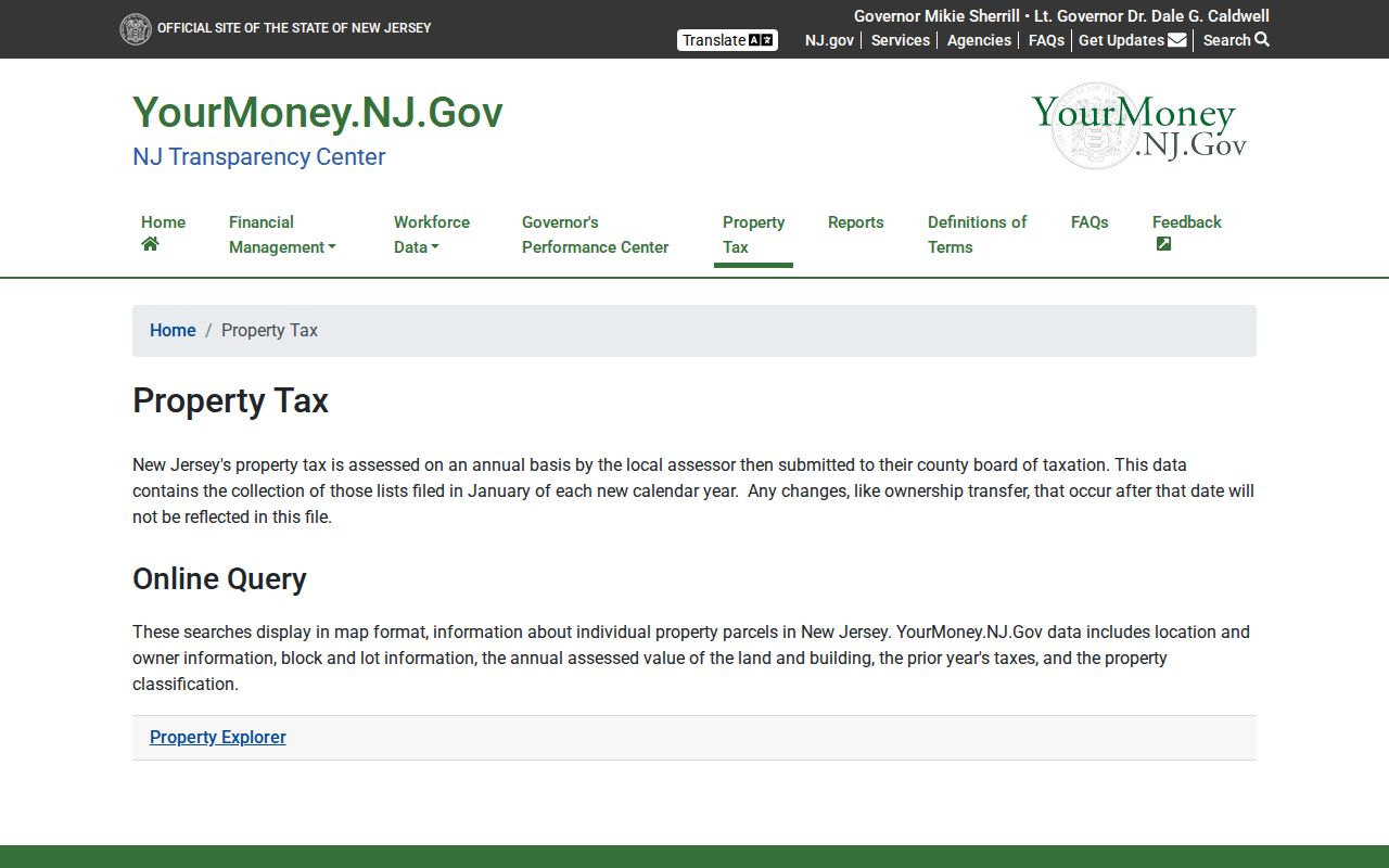
Use the map to connect a postal address to a property research path, then preserve the source date and parcel identifier. For recorded transfers, the Bergen County Clerk’s land-record index is a separate system with online coverage from January 1, 1970.
When a title chain reaches that online cutoff, move to the County Clerk’s deed books, microfilm, or in-person research route. County staff can explain the system and provide public viewing or copies, but they cannot perform a search for a requester. Search spelling variations and both borough names before treating a missing online entry as a dead end.
Elmwood Park ZIP Code Numbers in Context
Postal labels are broad because the borough itself is compact. The Census profile reports 21,422 residents in 2020 and land area of about 2.6 square miles. Those are place-level numbers, not facts about any named person. In a small area, a repeated name benefits from more precise identifiers such as a street number, cross-street, election district, map sheet, or parcel block and lot. The Census profile provides the place context, while official postal and county sources handle address verification.
The borough’s earlier history records 19,403 residents in 2010. These changing totals describe the place over time, not a directory of individuals. They reinforce why a search should keep a date and a record type beside every postal or property result.